Walking Along the Mithi River: Five Opportunities To Improve Flood Resilience
The third and concluding photo essay of the Mithi River series looks at enhancing the river's capacity for flood resilience through planning and design. We highlight five opportunities to adapt open spaces for absorbing and holding water at strategic locations along the river’s stretch. Read the first and the second blog of the series on our website.
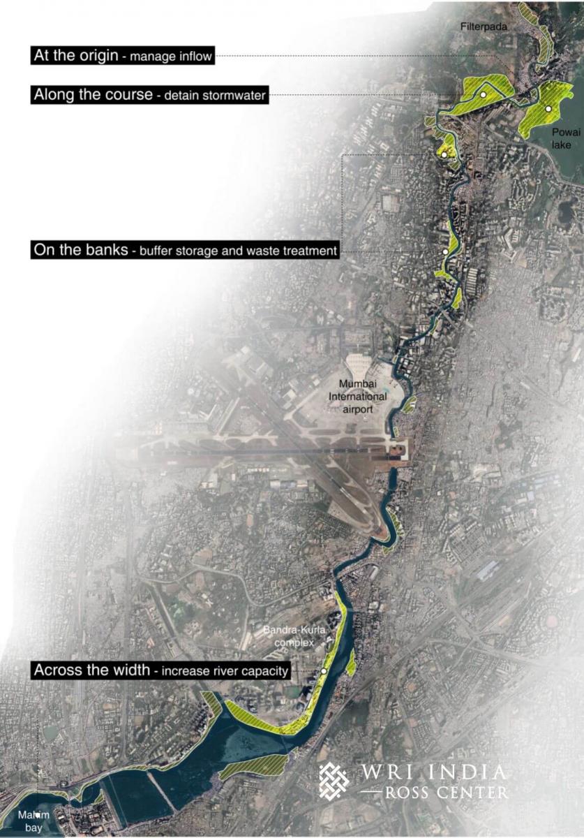
At the Origin – Holding Excess Stormwater Flowing to the River
Abhijit started his walk south of Vihar Lake, near the river’s origin. He came upon a channel carrying the water from the lake into the river. Heavy rain often increases this flow from the lake and strains the river’s capacity.
While the Powai Garden houses this overflow channel to the river, it could play a larger role as a floodable landscape to store excess stormwater. Creating such buffer storage would involve integrating natural ponds and streams into the garden design, to detain excess flow to the river.
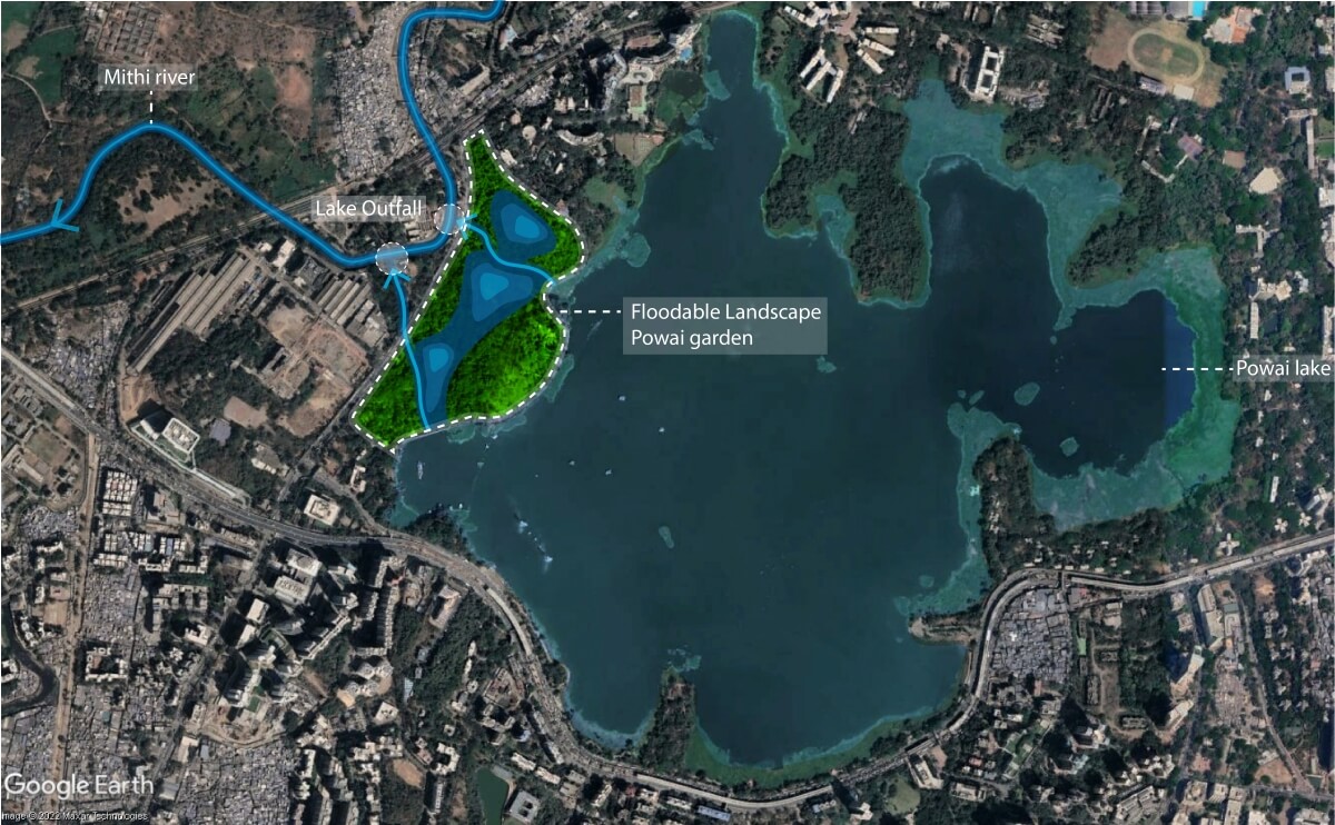
This would require a cross-departmental effort involving the Brihanmumbai Municipal Corporation’s stormwater drainage and garden departments, as well as experts on stormwater management, greening, biodiversity and urban design.
Along the Course – Delaying Flow to Downstream Areas
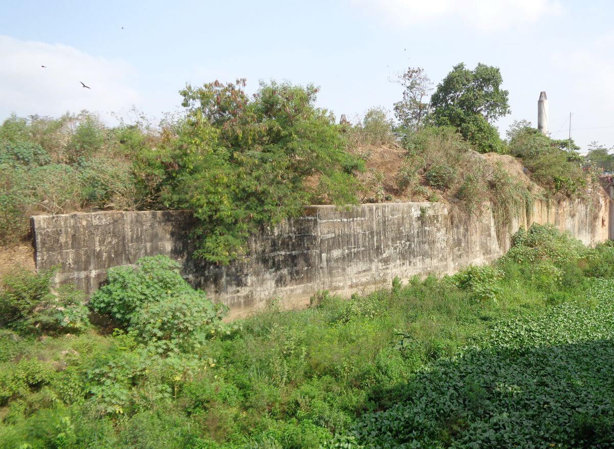
The first blog in this series discussed how the river is channelized into an open drain for flood control and the challenges that the retaining wall poses. West of Powai Lake’s northern tip, the river is channelized even though it passes through an uninhabited open space.
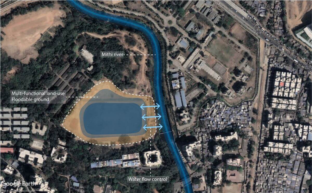
Opening this natural space could allow the river to “swell” during periods of heavy rainfall. As a smaller- version of the Room for the River project in the Netherlands, it could be designed as a floodable space to protect downstream urban areas.
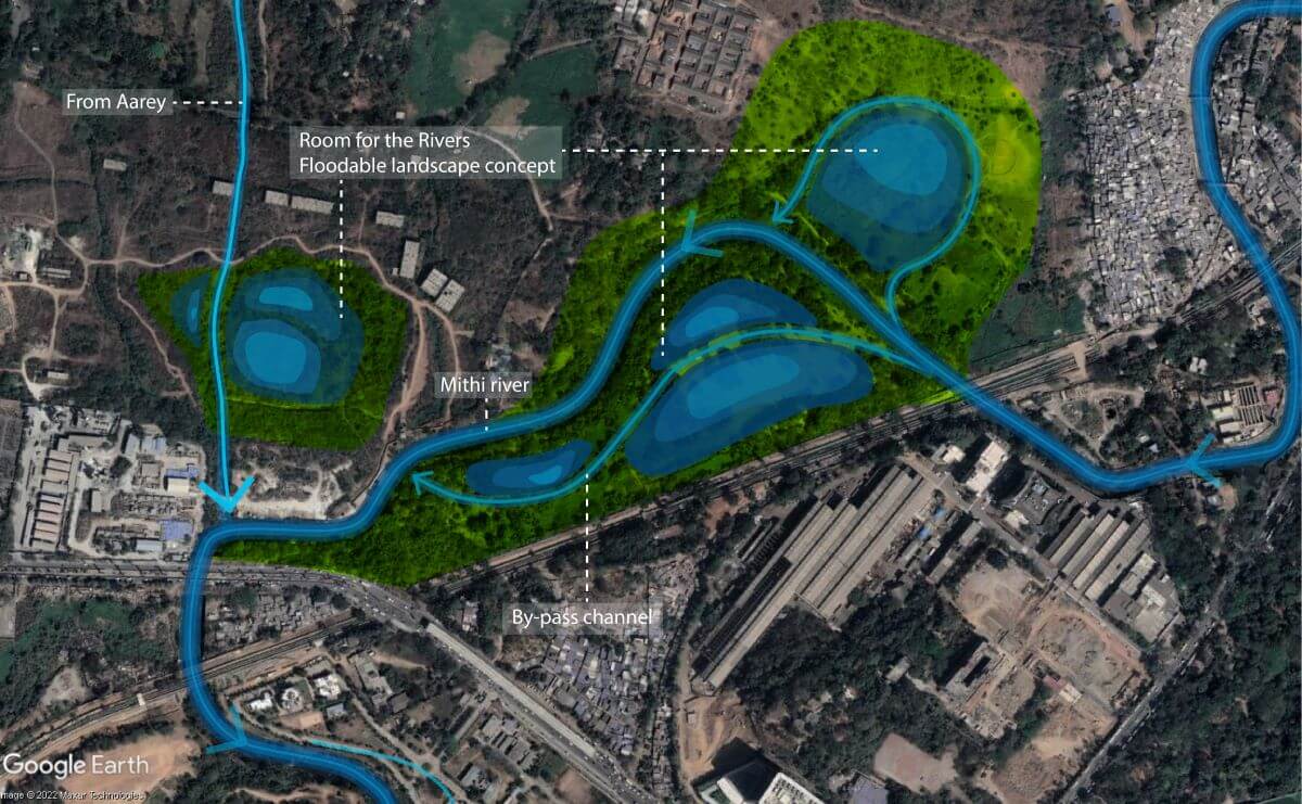
Given the complexity of land ownership that sees various stakeholders in the region, such as settlement dwellers, industries, the municipal corporation, the Maharashtra Forest Department and private land developers; coordination and engagement are crucial for successful implementation.
On the Banks – Managing Waste With Multi-functional Land-use
The second blog of the series explained how waste ends up in the river through stormwater drains, underlining a gap in existing waste management systems. Appropriating riverside buffer spaces for multipurpose use could accommodate waste treatment systems and help reduce the vulnerability of settlements along the river. Processes for creating public-private partnerships, cross-departmental collaboration, and community participation to establish ownership towards such spaces is crucial. Furthermore, buffer spaces by the Mithi would help in reducing the urban heat island effect and improve riverine health.
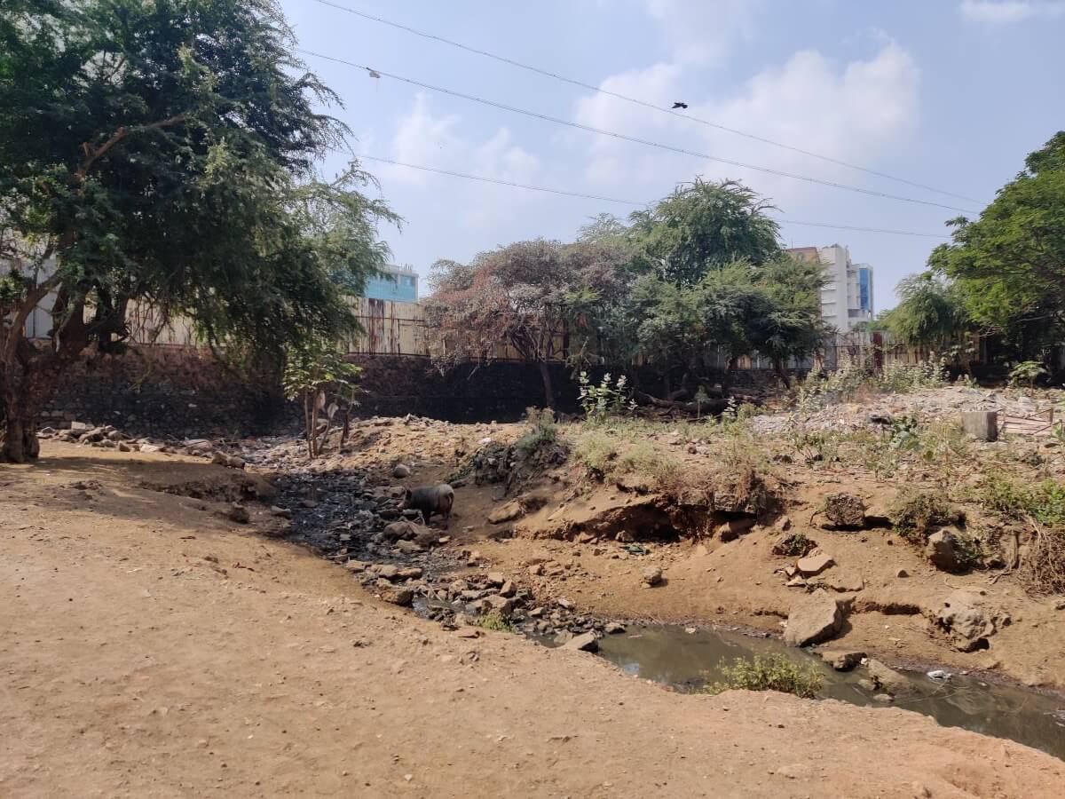
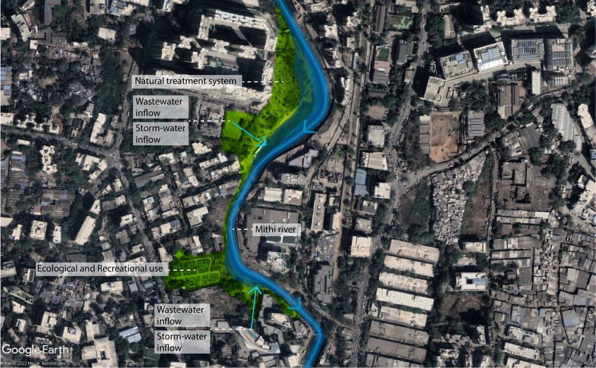
Recreational land, such as a maidaan (playground), can detain excess stormwater when a river water surge submerges stormwater drain outlets to the river. Public safety protocols for the area can be based on the rainfall intensity and the usage patterns in and around the designated floodable space.
Across the Width – Re-imagining the River’s Edge To Accommodate Stormwater
Closer to Mahim Bay, the Mithi River is diverted sharply at the airport and the Bandra-Kurla Complex (BKC), further constricting the river and disconnecting it from the city. The existing riverside landscape, in the BKC area, is a missed opportunity in combining flood prevention with accessible open spaces along the river.
This requires reimagining the design of the river’s retaining wall. Its function should not be limited to flood prevention but must also incorporate accessibility to the river's edge, recreation opportunities along the river, natural wastewater treatment systems and habitat creation that conserves the riverine ecosystem.
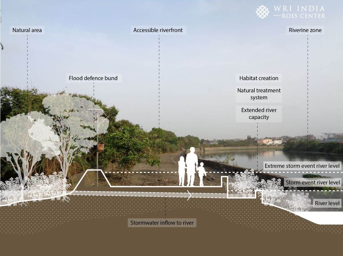
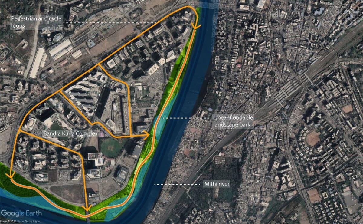
It is evident that putting the onus on a retaining wall to flood “control” the Mithi is unsustainable. The river needs a multi-pronged approach towards flood resilience, clean water and access to green spaces through stakeholder engagement, interdepartmental coordination and water-sensitive planning.
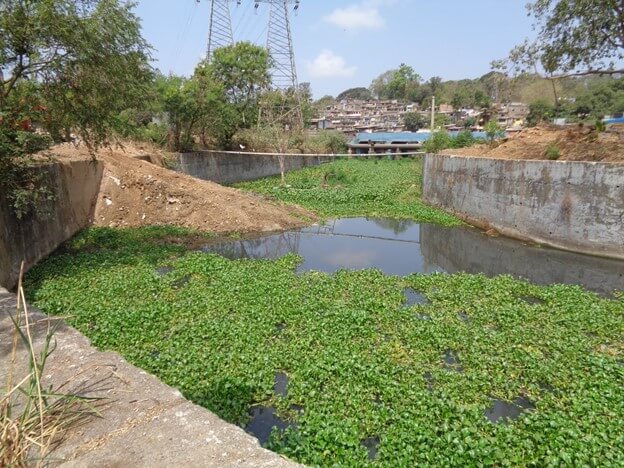
Ironically, signs of a riverside environment were elusive during Abhijit’s walk, with Mumbai’s access to its river being largely unplanned punctures in its urbanization. The photos in this essay reveal the varied roles that riverside open spaces could play. Buffers at strategic locations could eliminate the need for “training” and widening the river and provide excellent opportunities for integrated river management.
Walking along the Mithi is an exercise in reimagining the myriad possibilities that a riverine ecosystem holds in terms of urban resilience and connecting citizens to the city’s precious natural spaces.
Abhijit Waghre interned with WRI India from April 6, 2022, to August 5, 2022.
All views expressed by the authors are personal.
